Image
Image
Image
Image
Image
Image
Image
Image
Image
Image
Image
Image
Image
Image
Image
Image
Image
Image
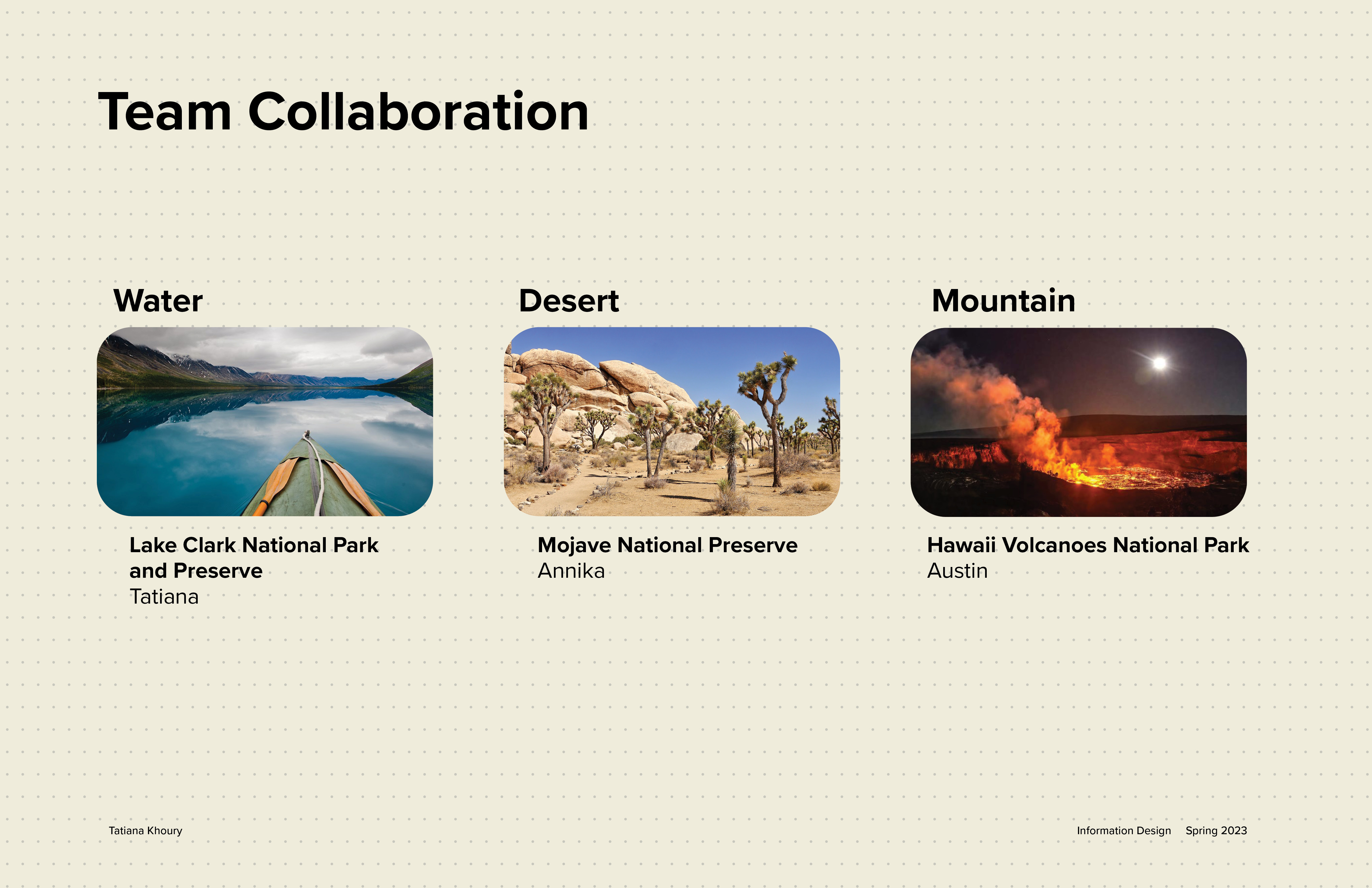
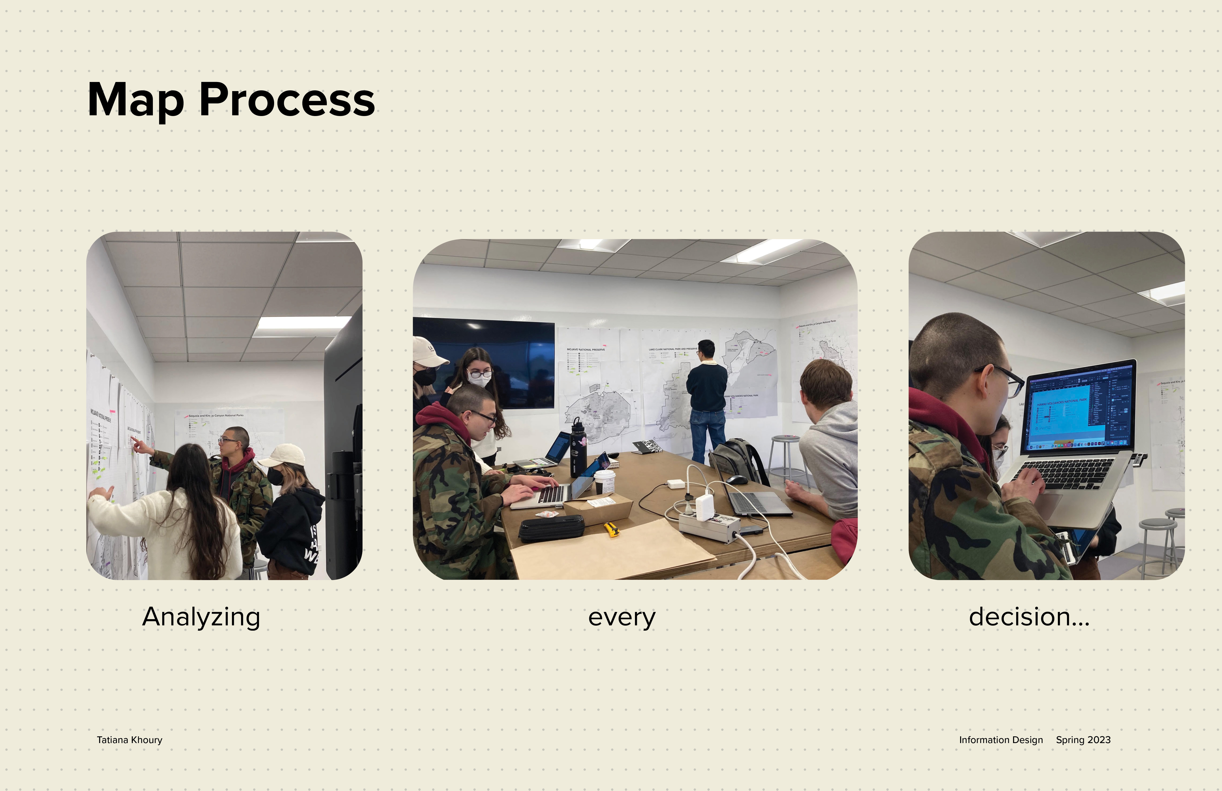
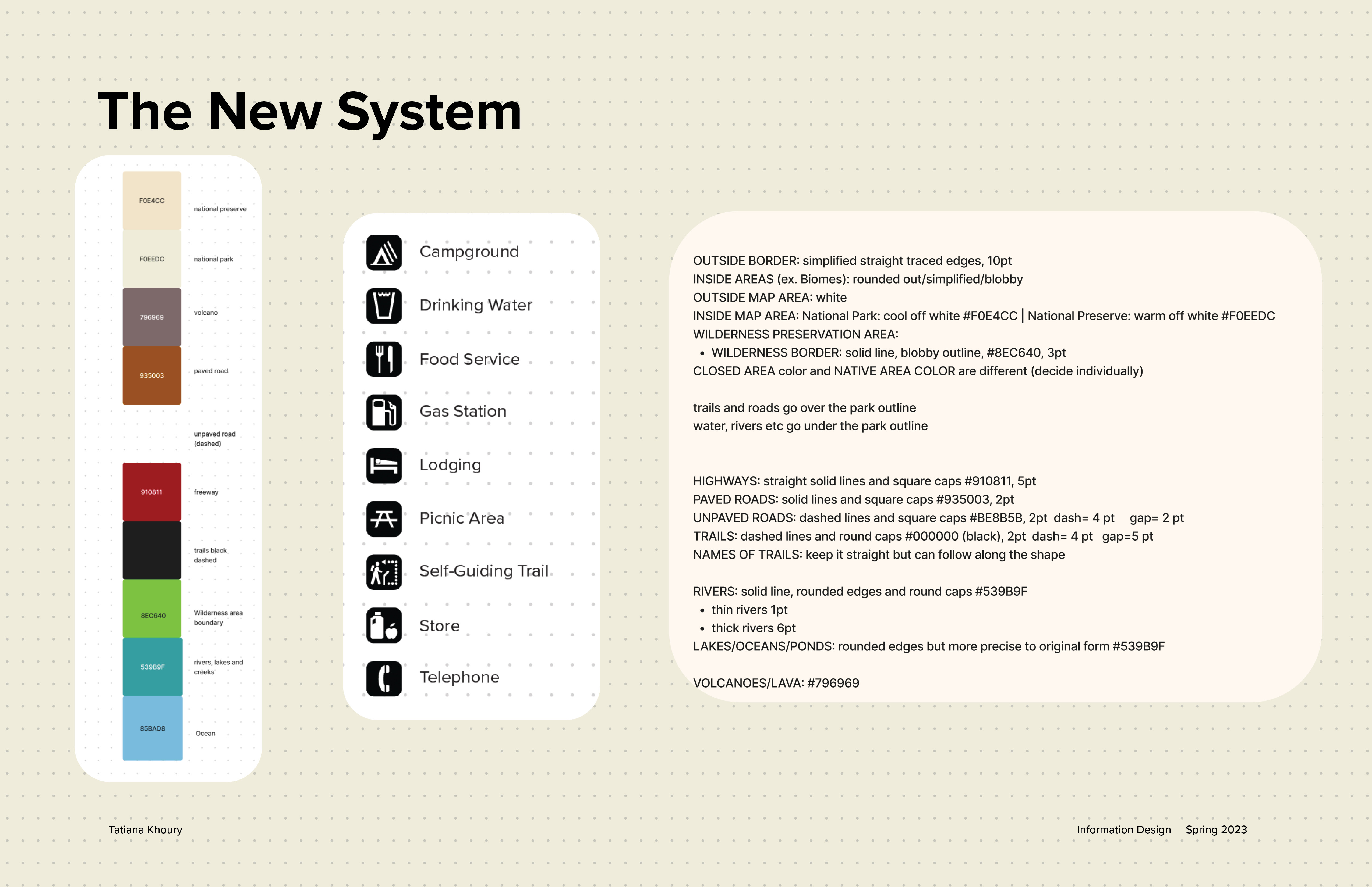
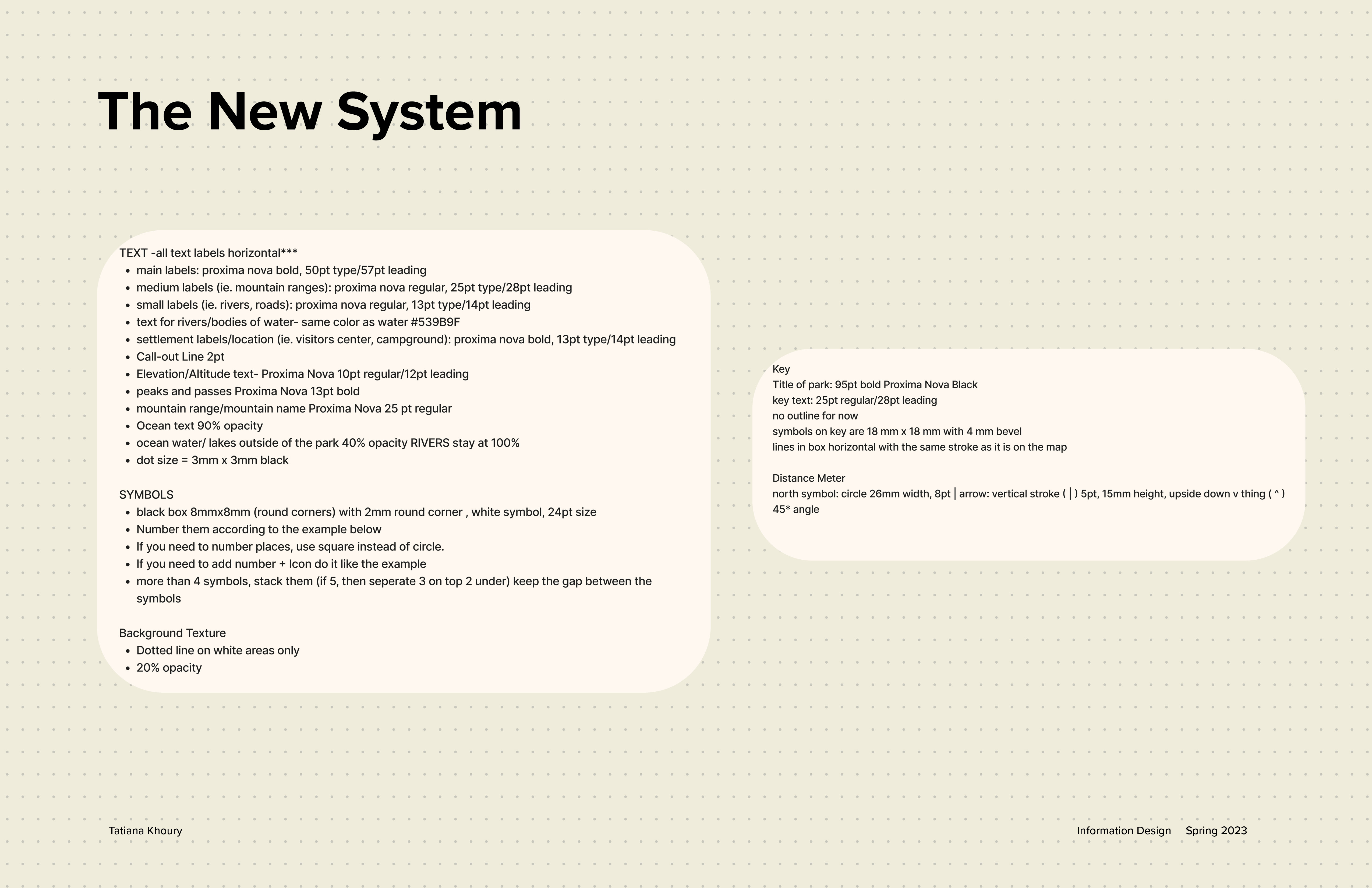
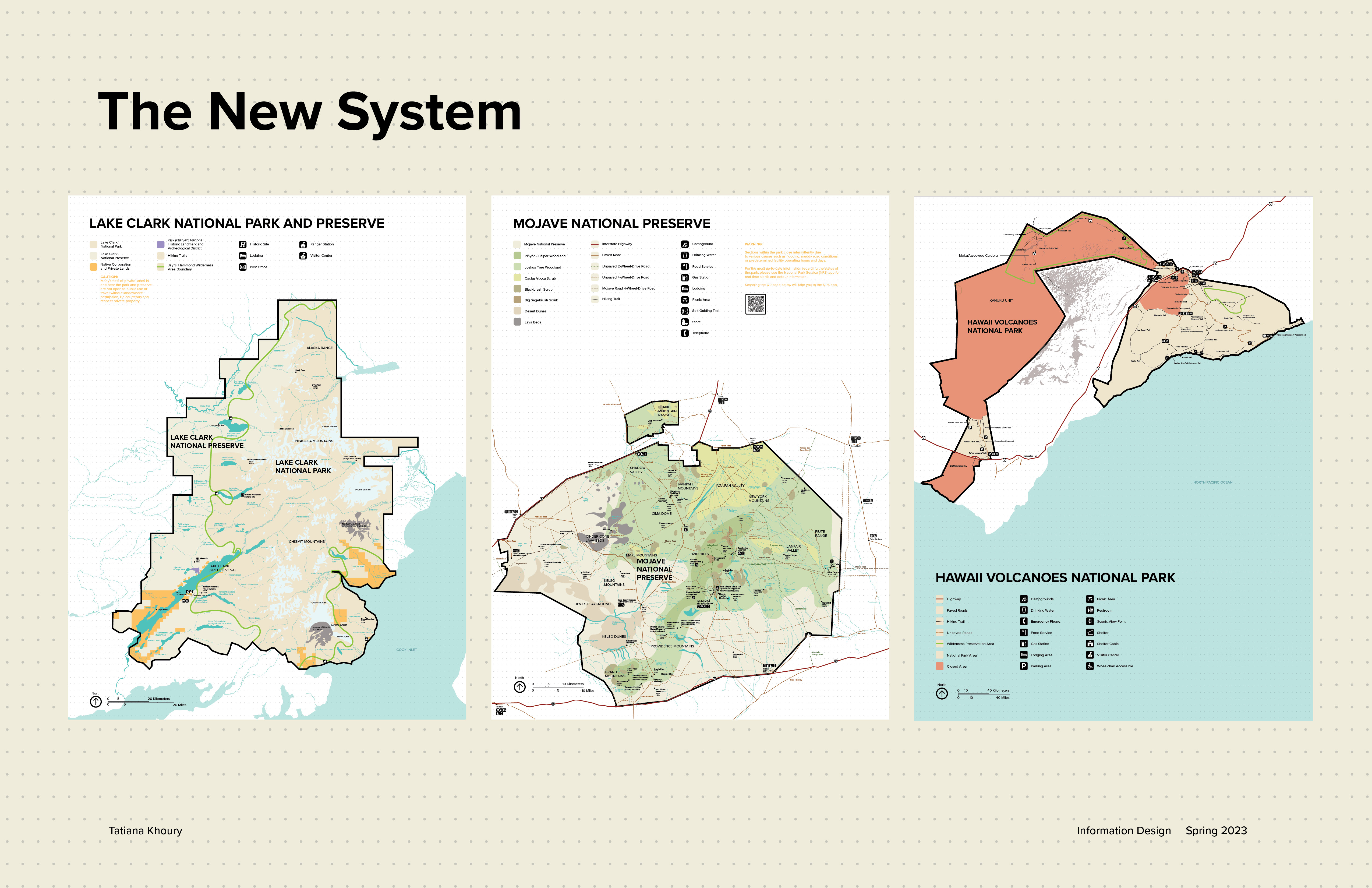
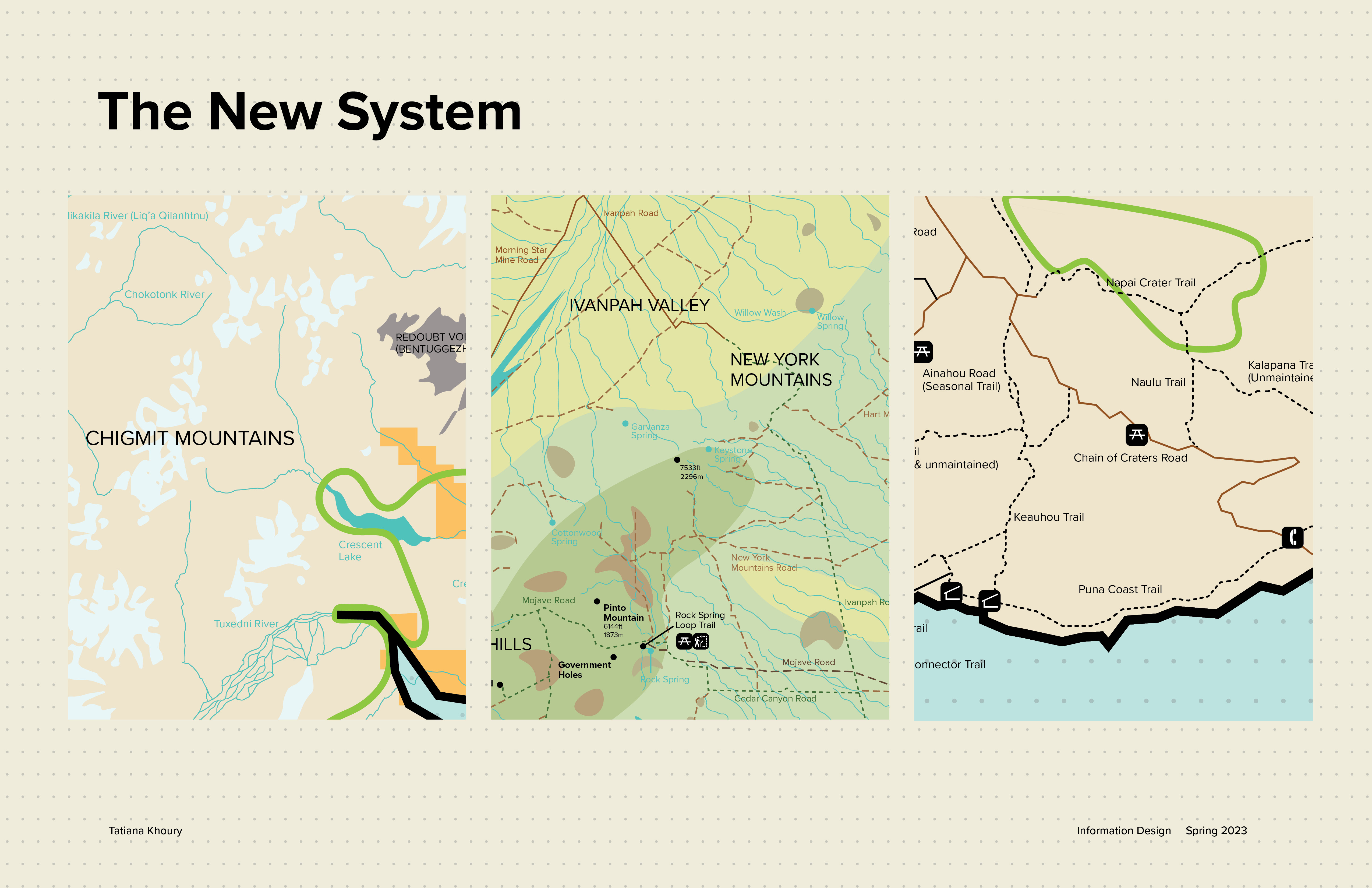
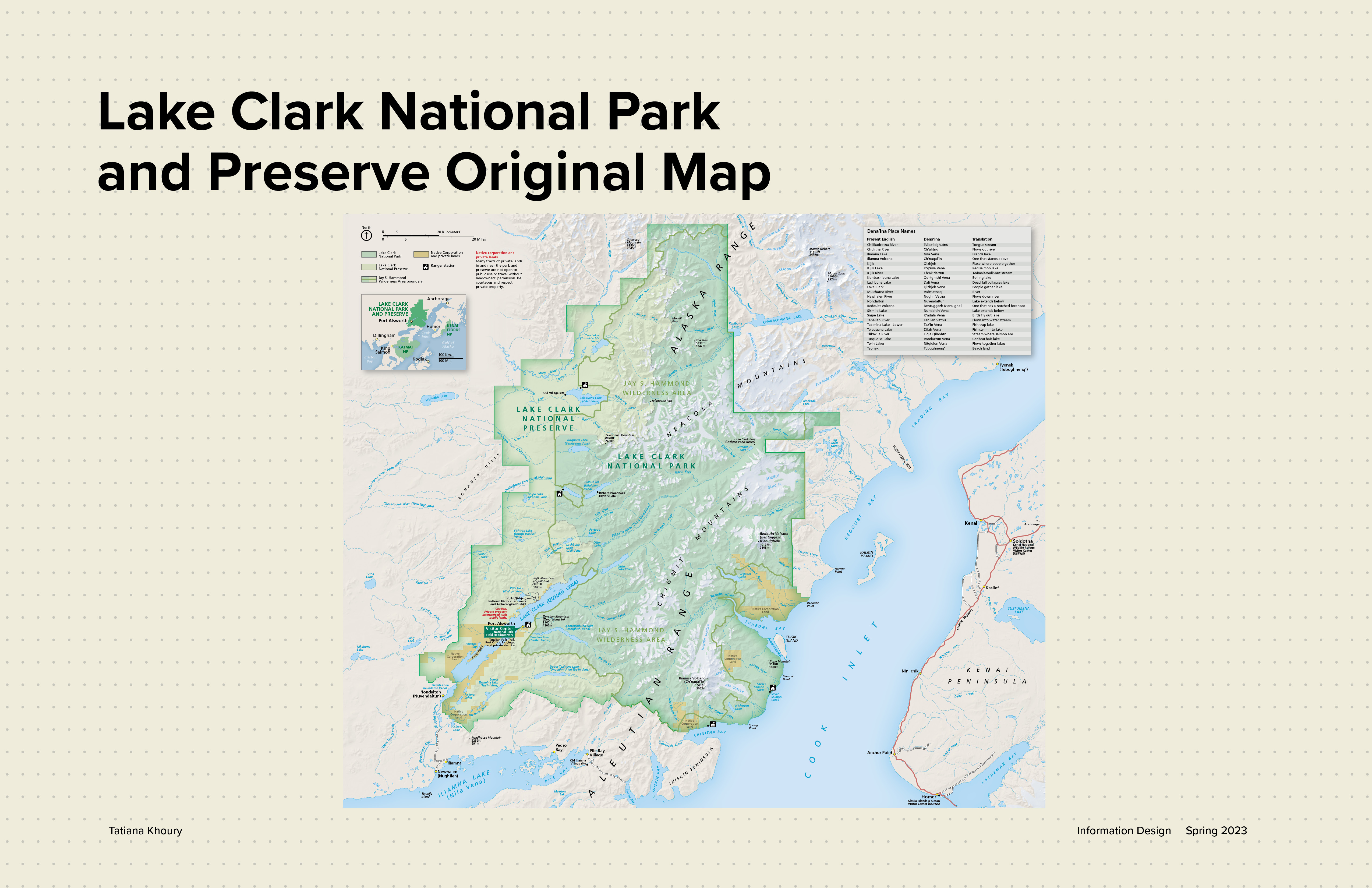
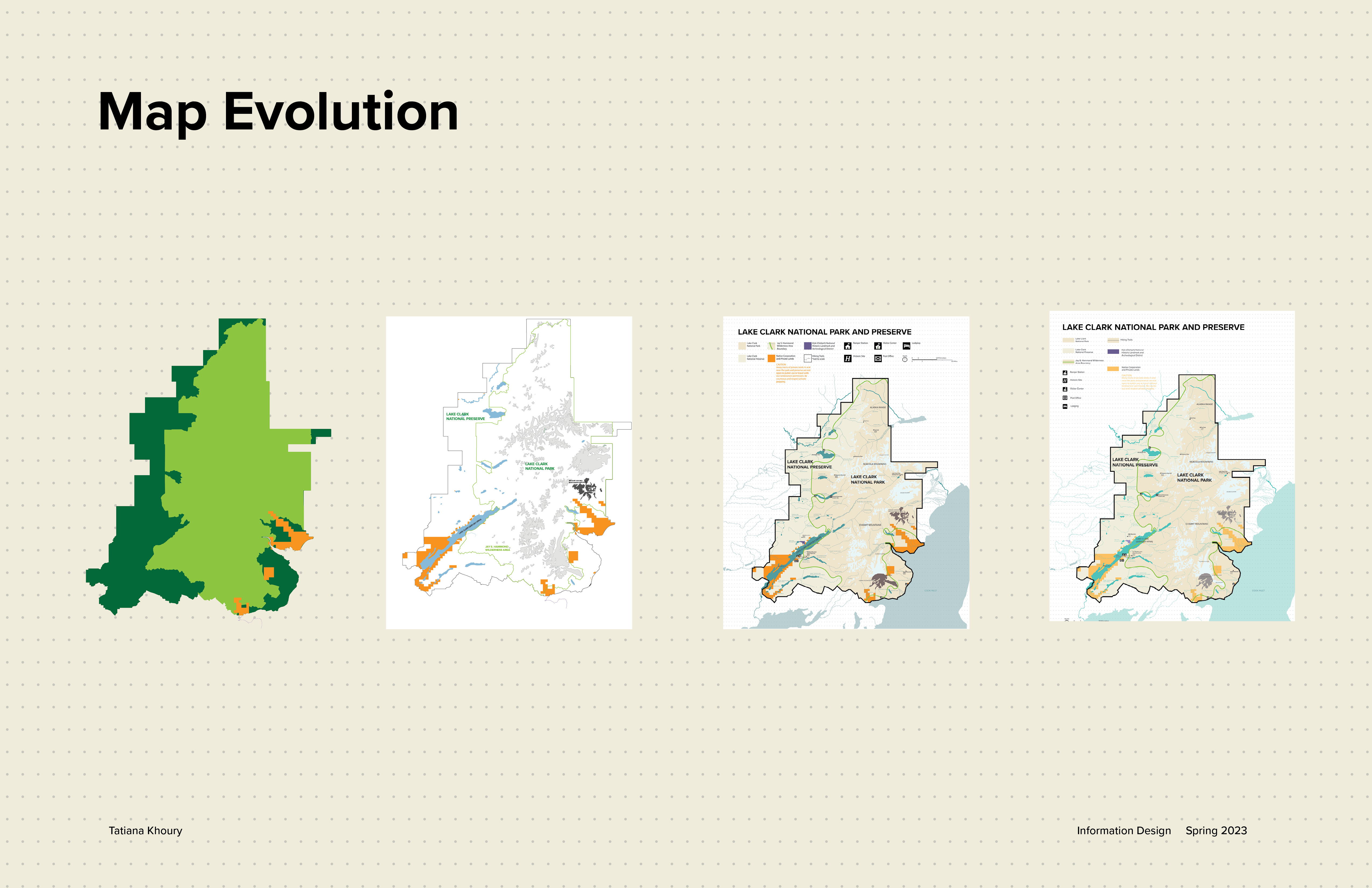
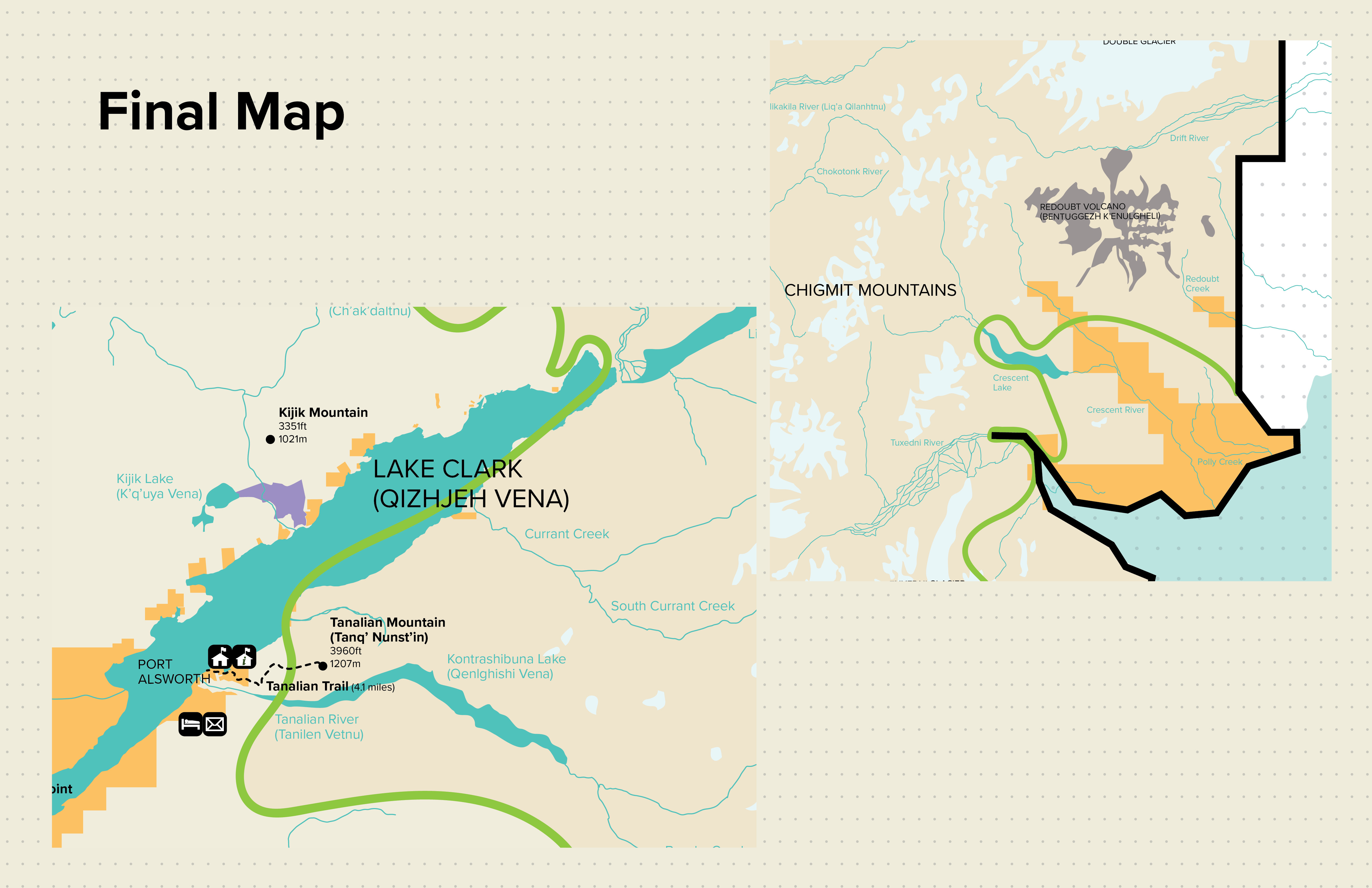
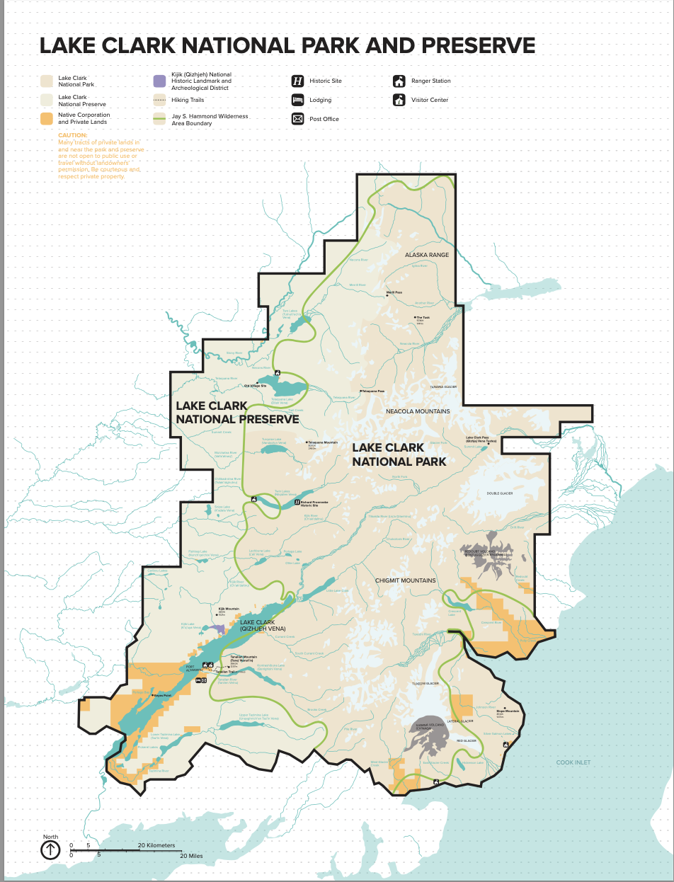
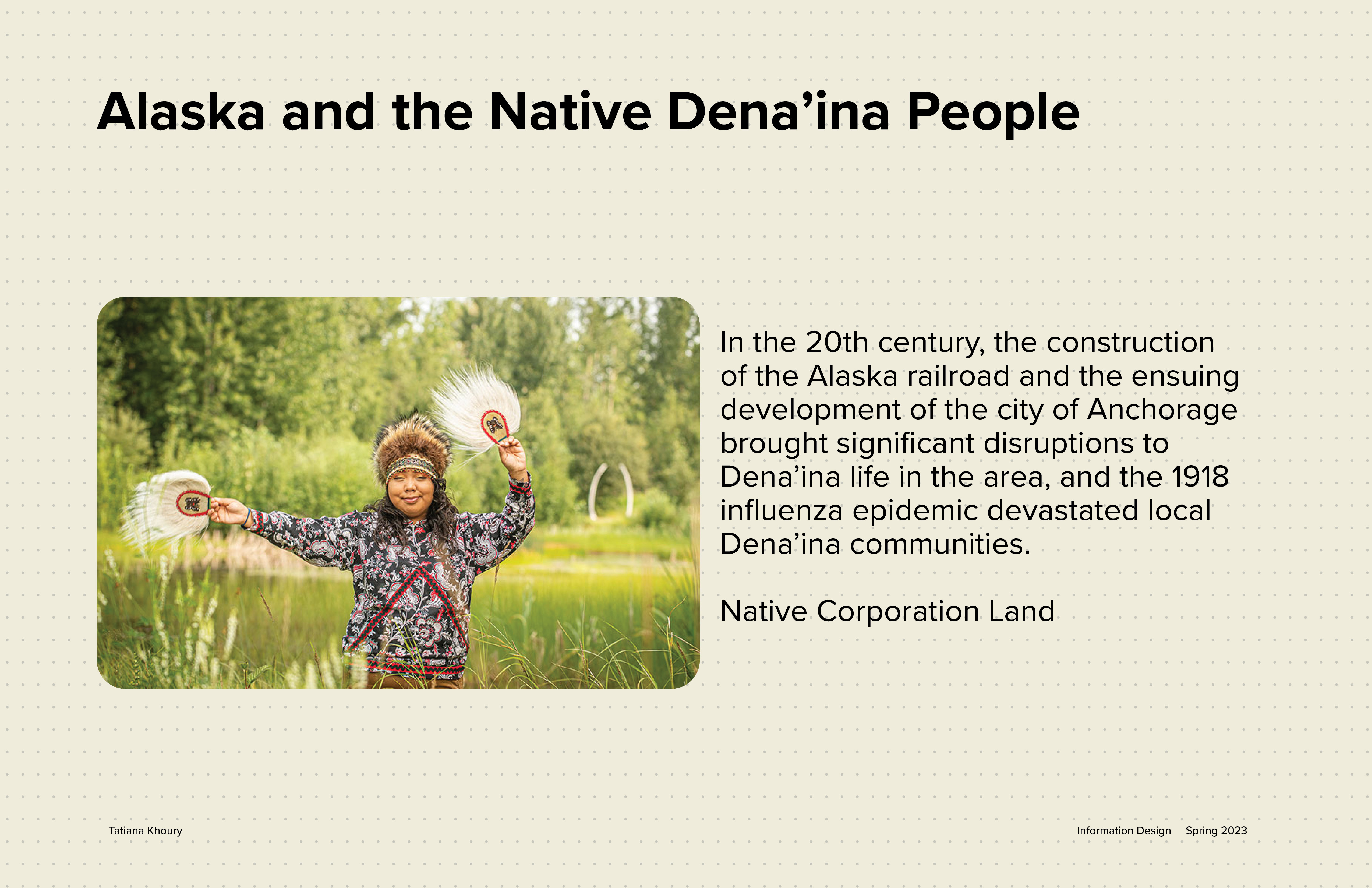
My National Park was huge in comparison to my team's Parks, so this played a huge factor in our system, design and scale of printout.
Image
Image
Image

Image
Image
Image
Image
Image
Image
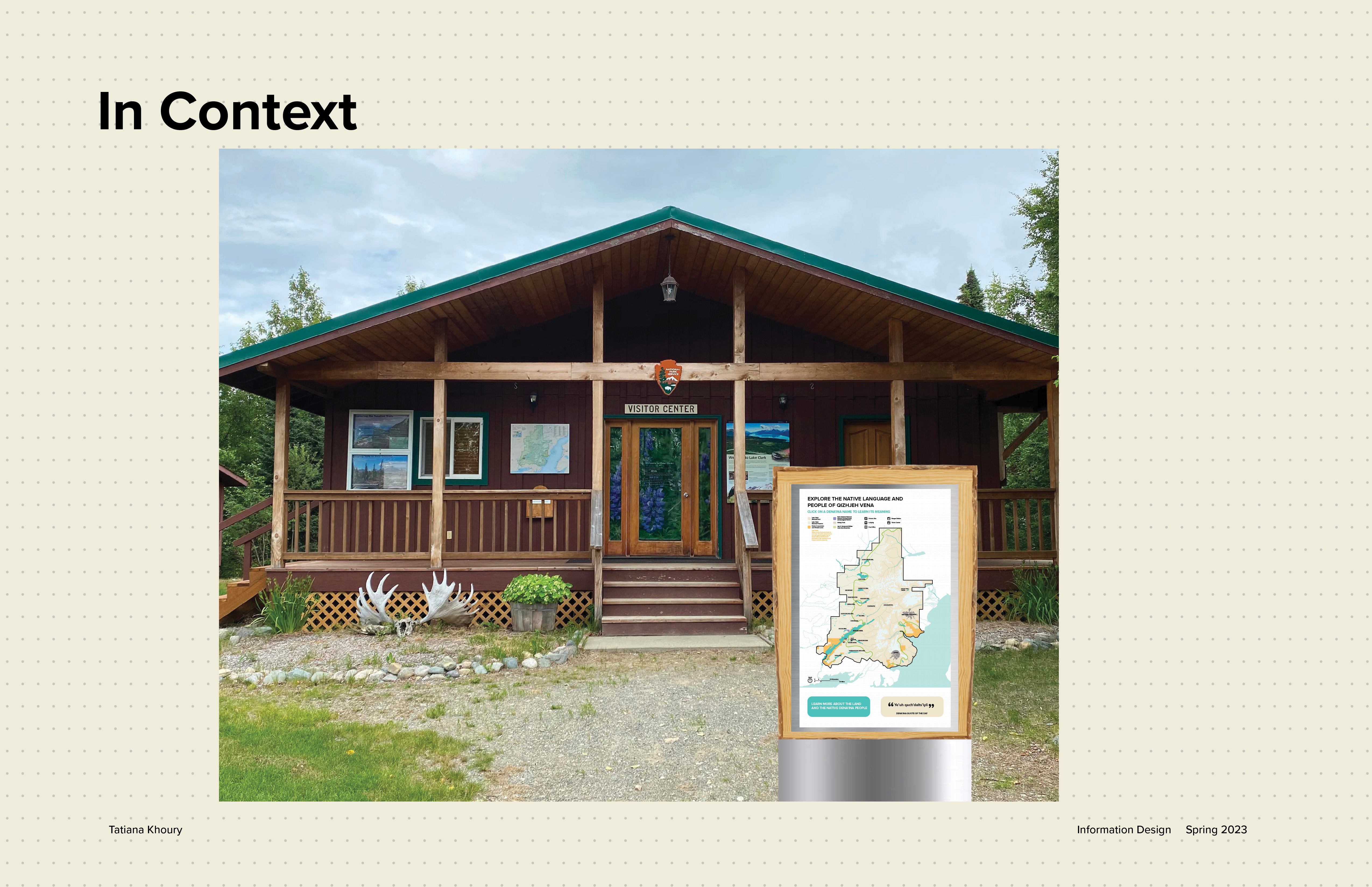
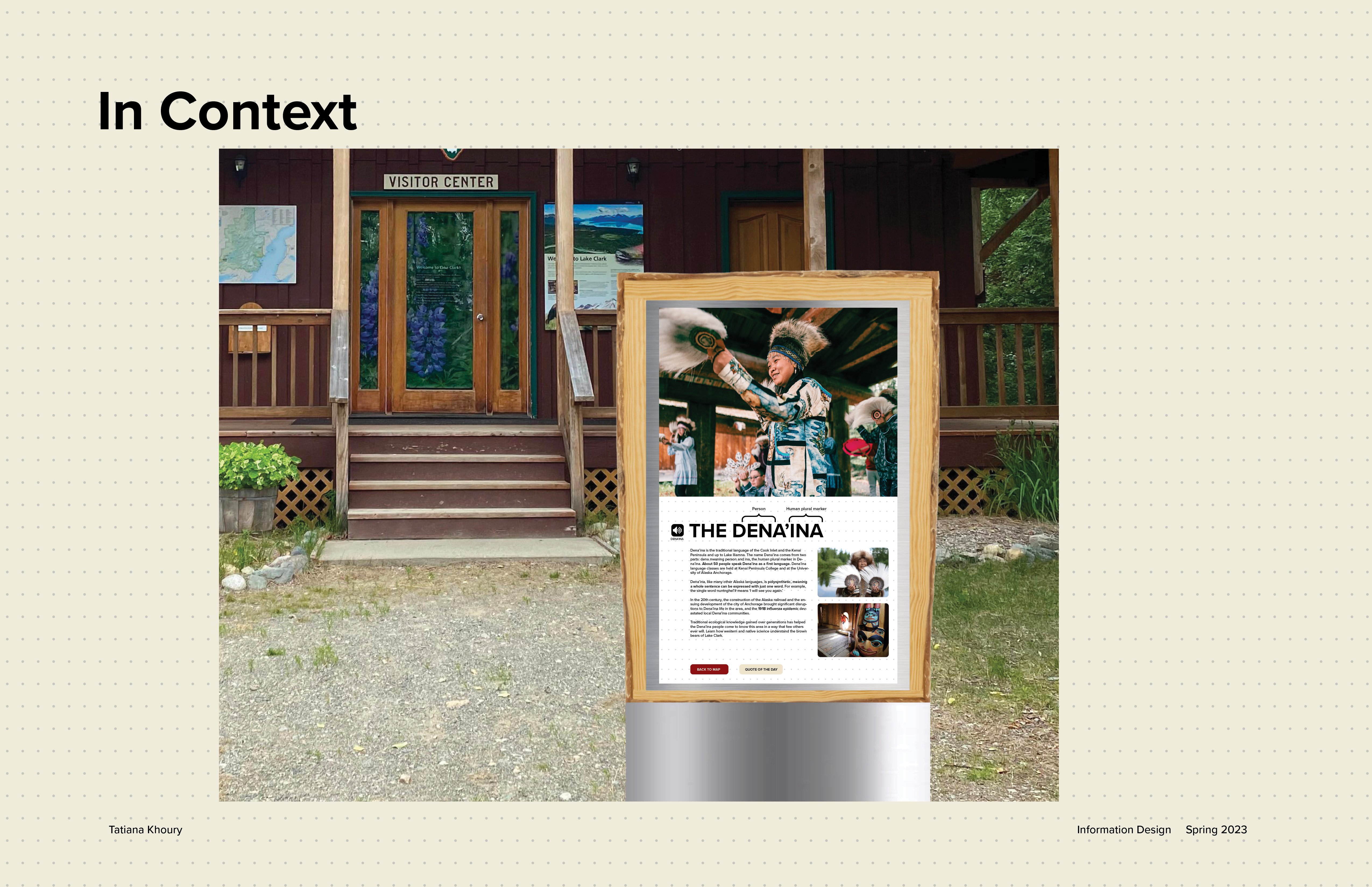
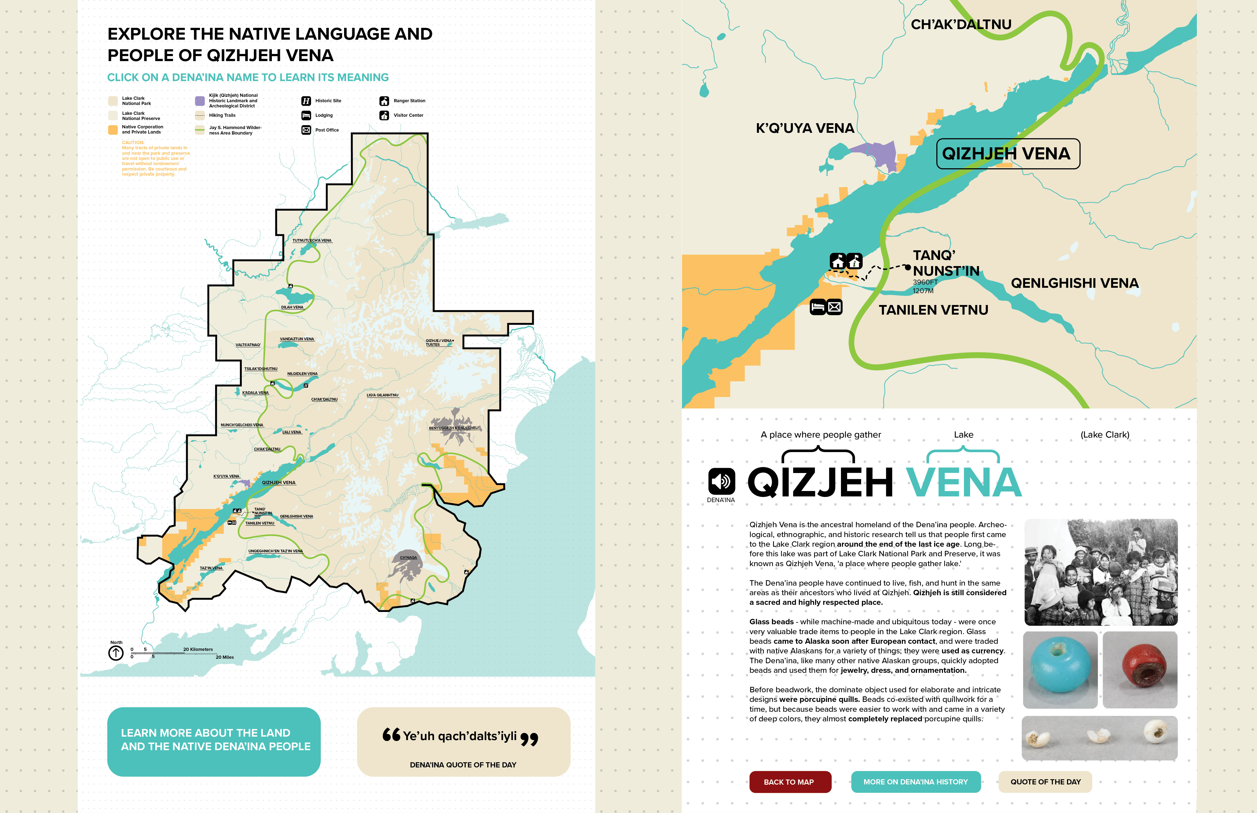
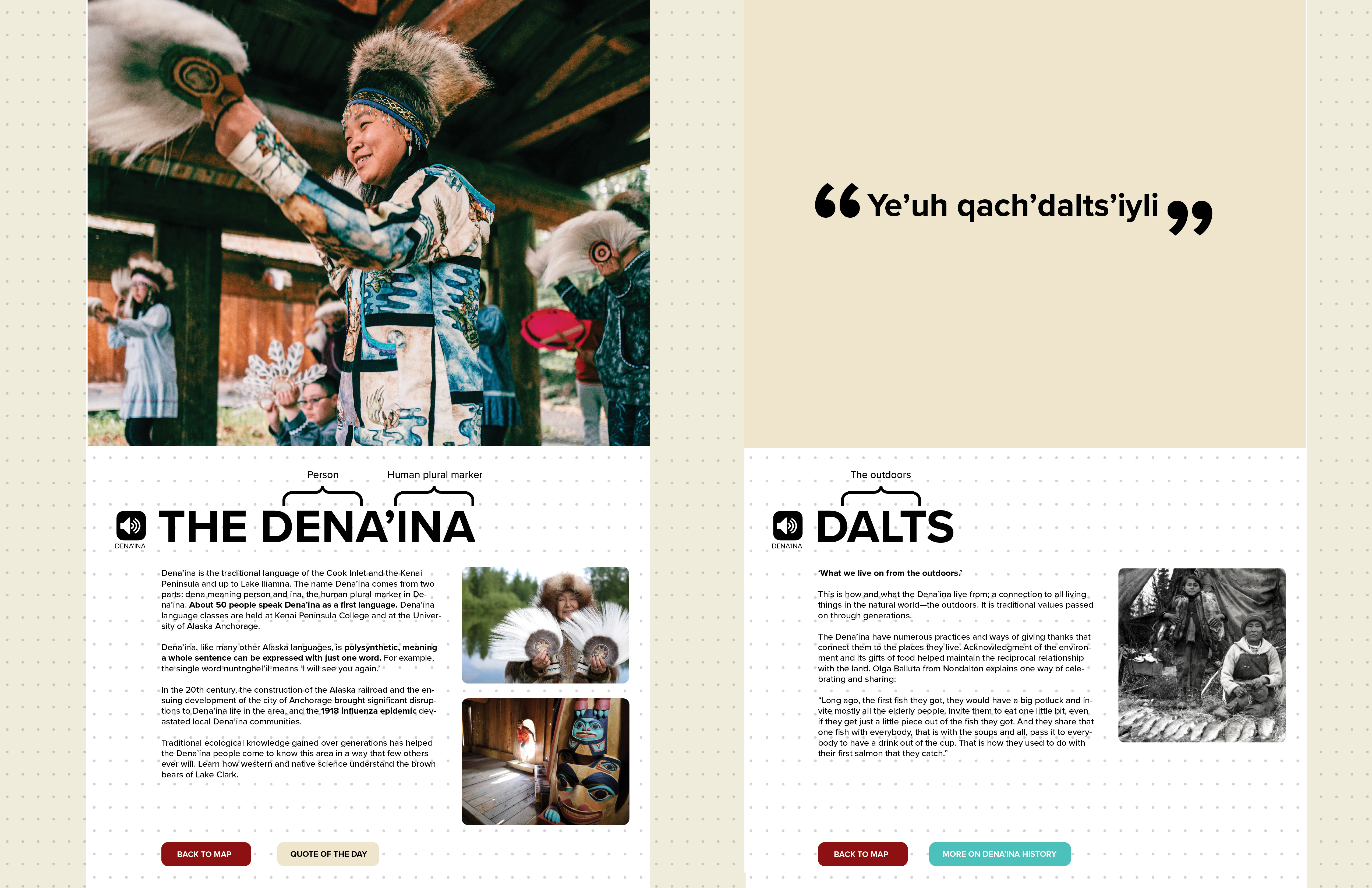
This is an interactive digital map that would be found in front of the parks visitor center
Image
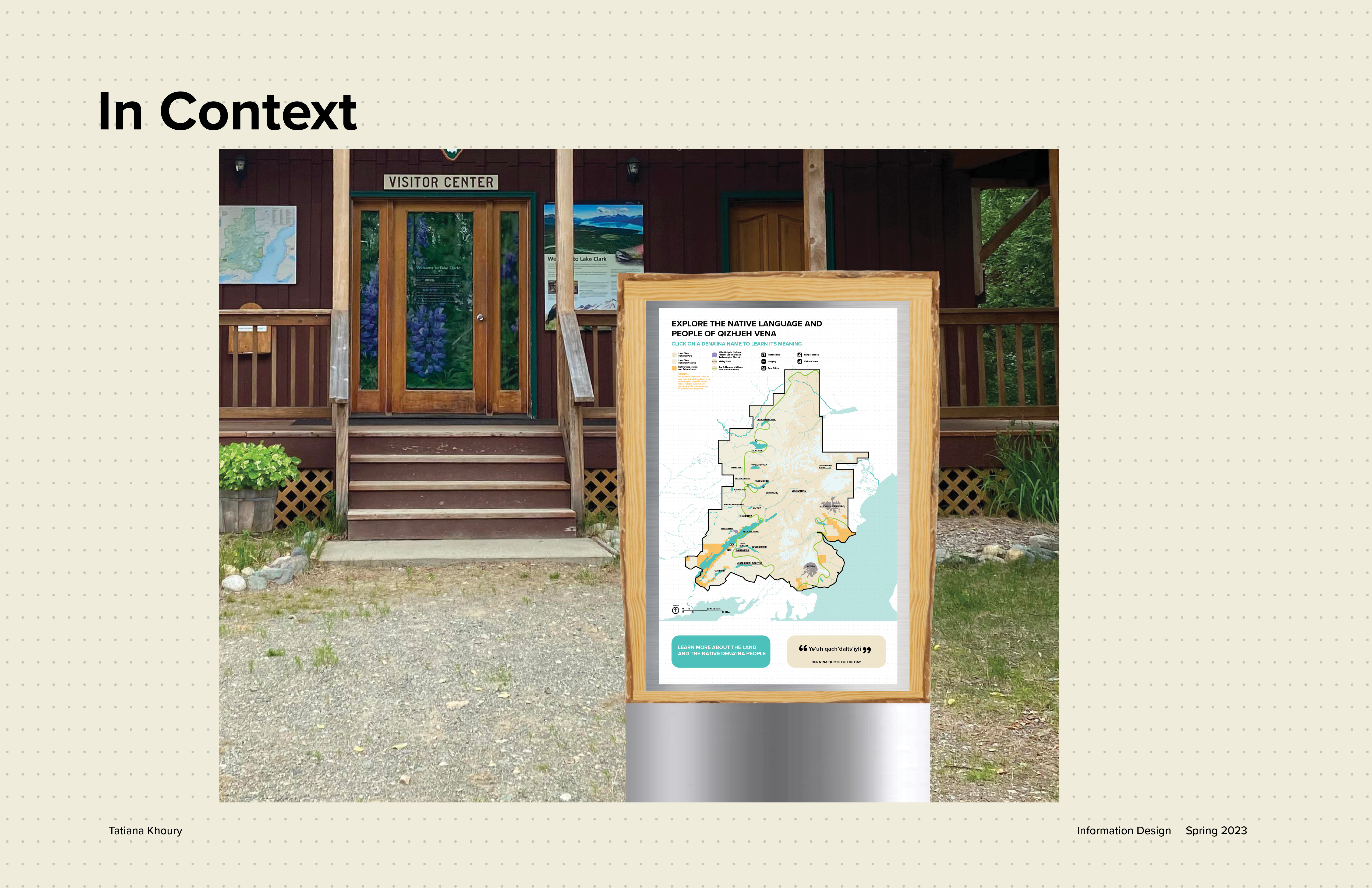
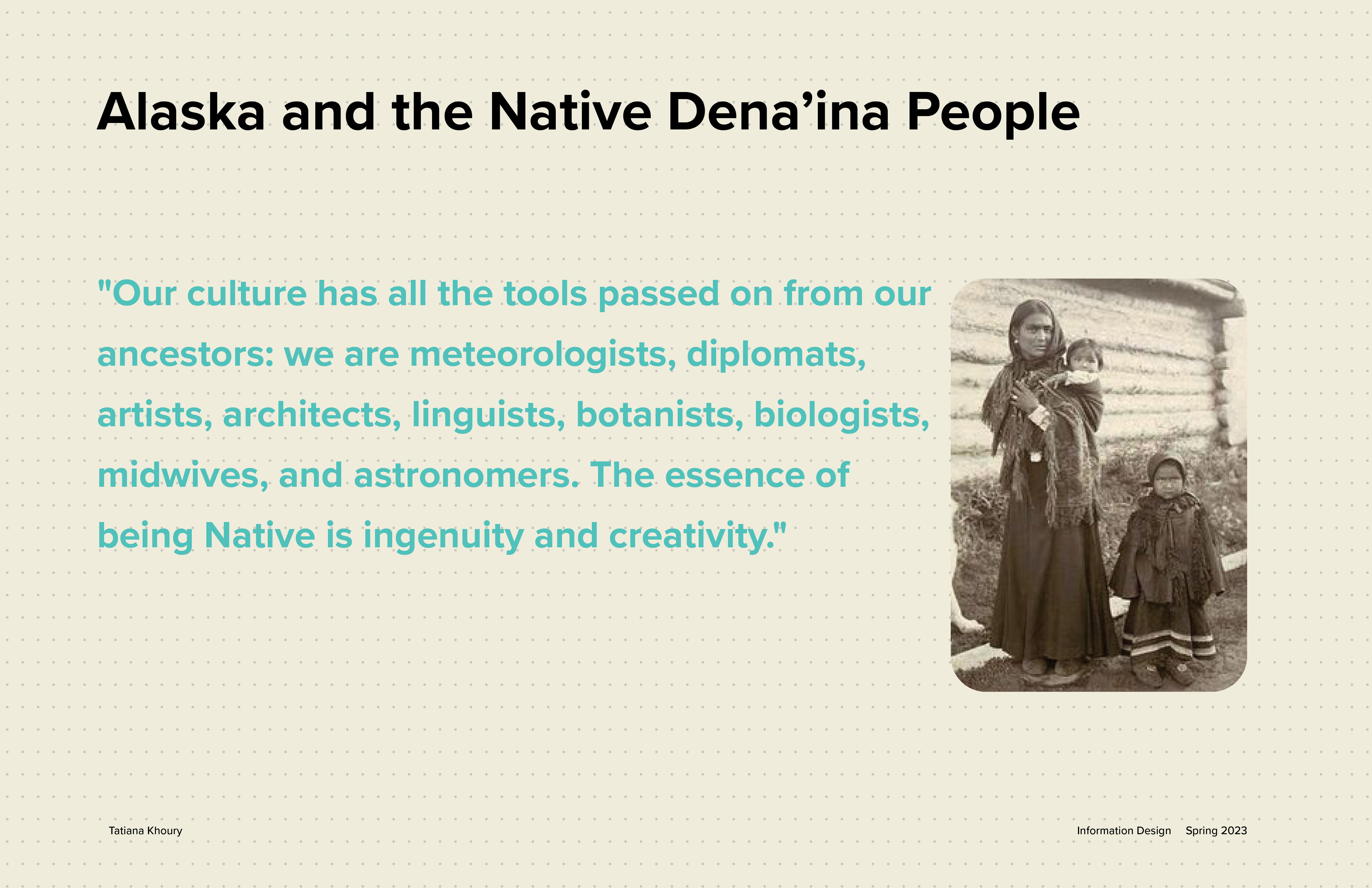
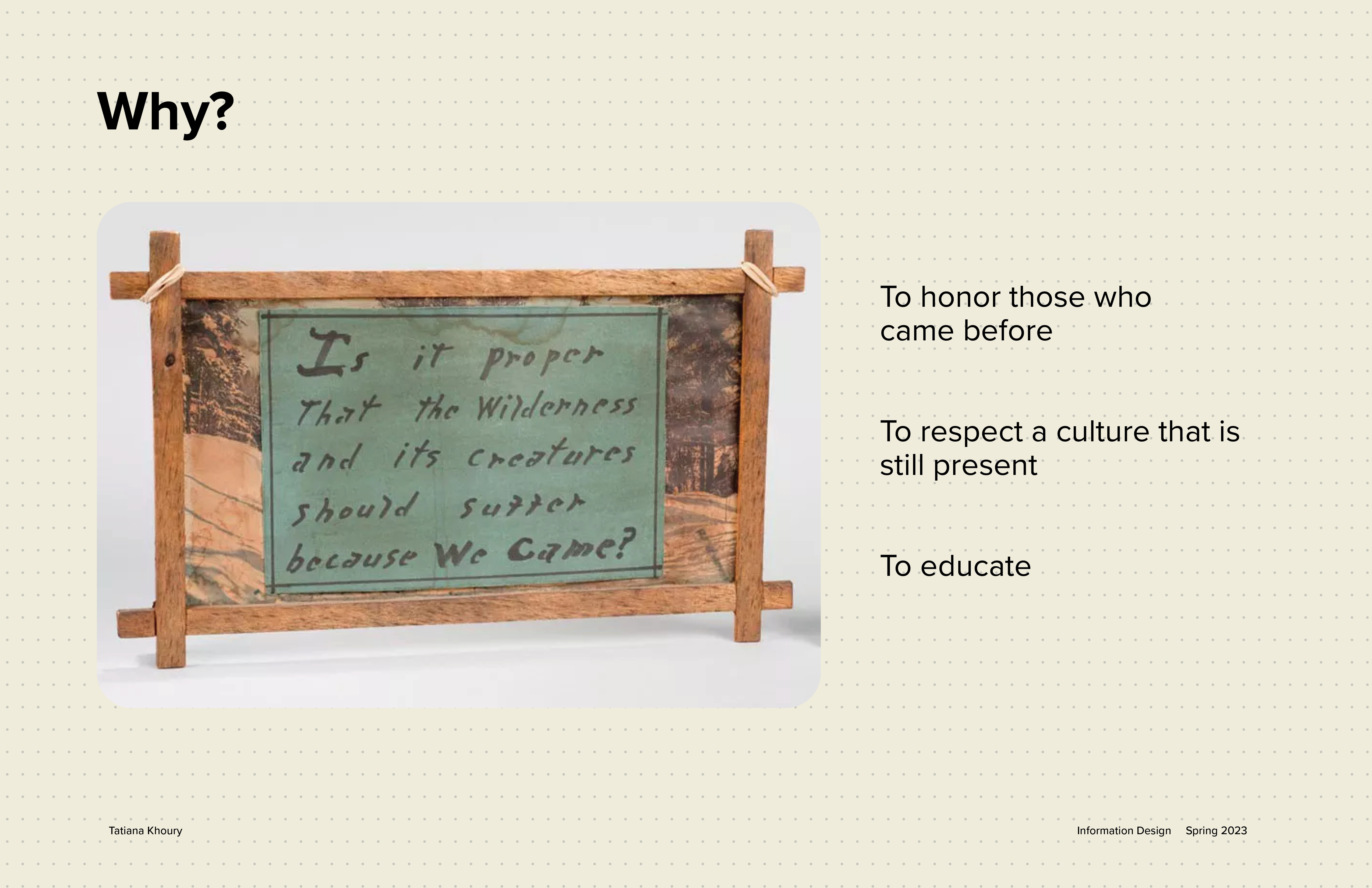
For my map in context, I created the whole map in the Dena'ina language. This is to respect the people and their land as we are visitors there. This also invites visitors to learn more and be educated on the Native land and people.
Image
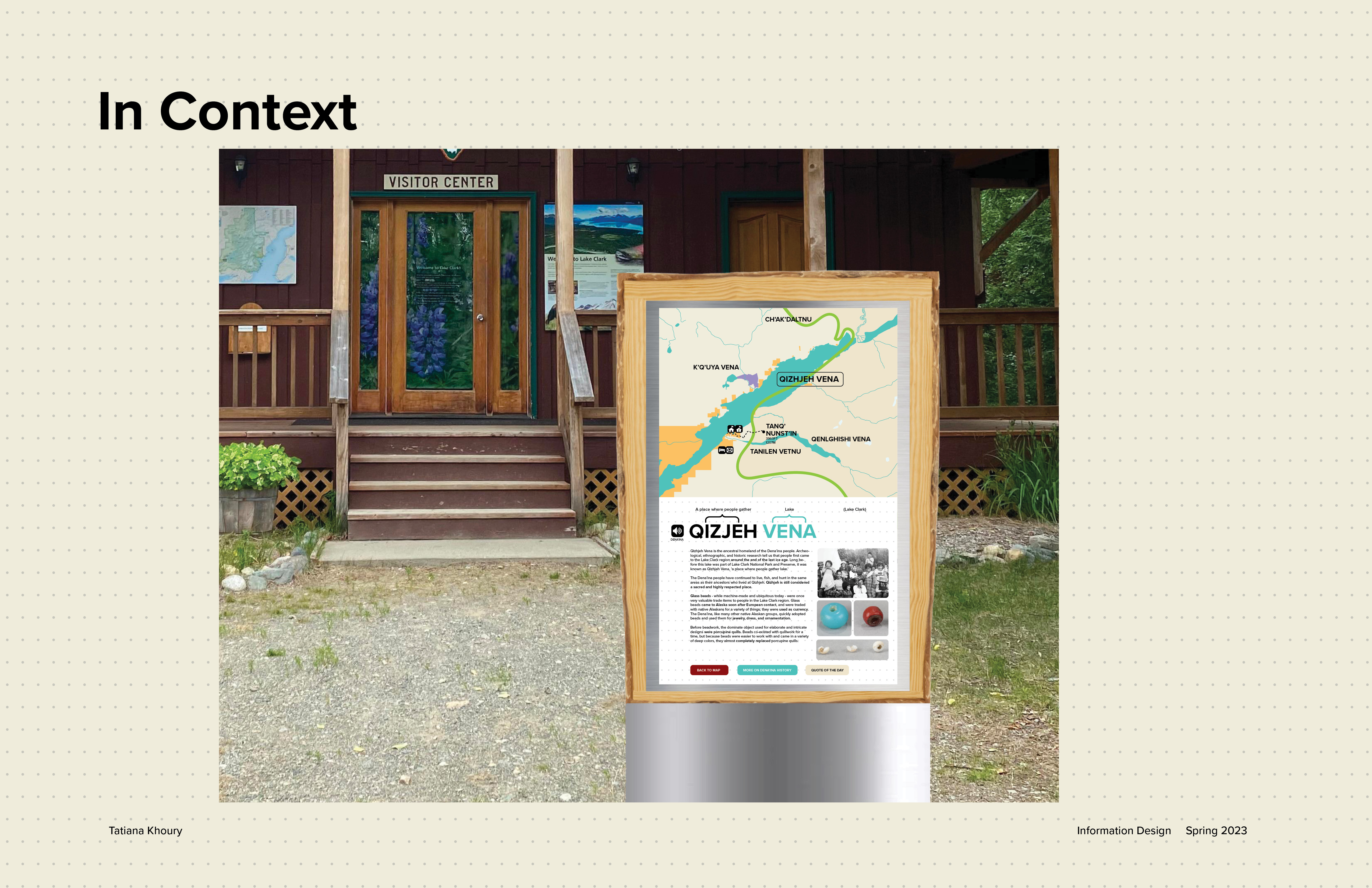
Once you click on a location on the map, it will pop up in Dena'ina with the option to hear the translation. I wanted people to be able to learn not only by reading but listening as well.
Image
Image
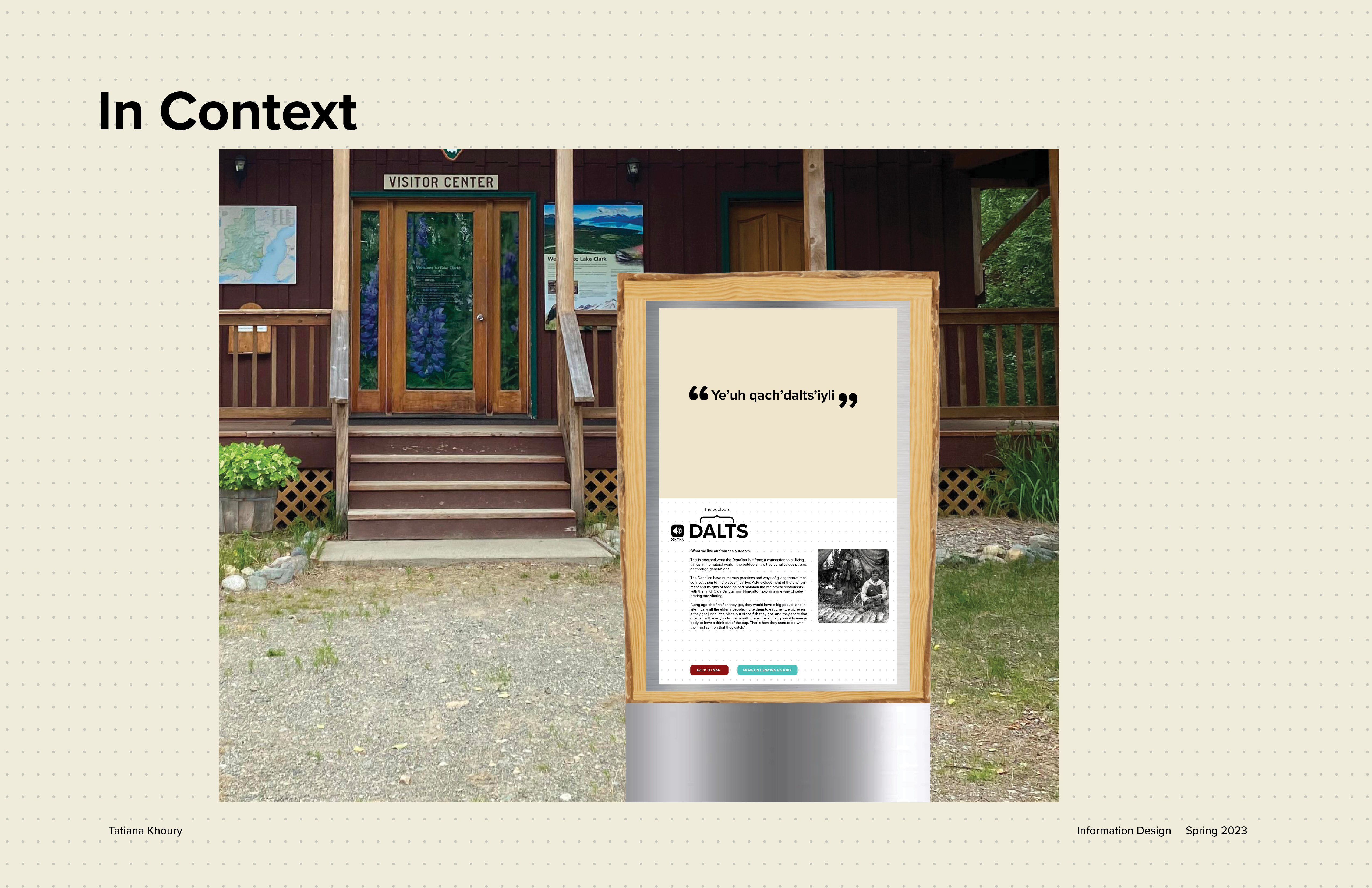
There is also a quote of the day feature on the interface which allows visitors to learn more about the history.
Image
Image
Image
Image
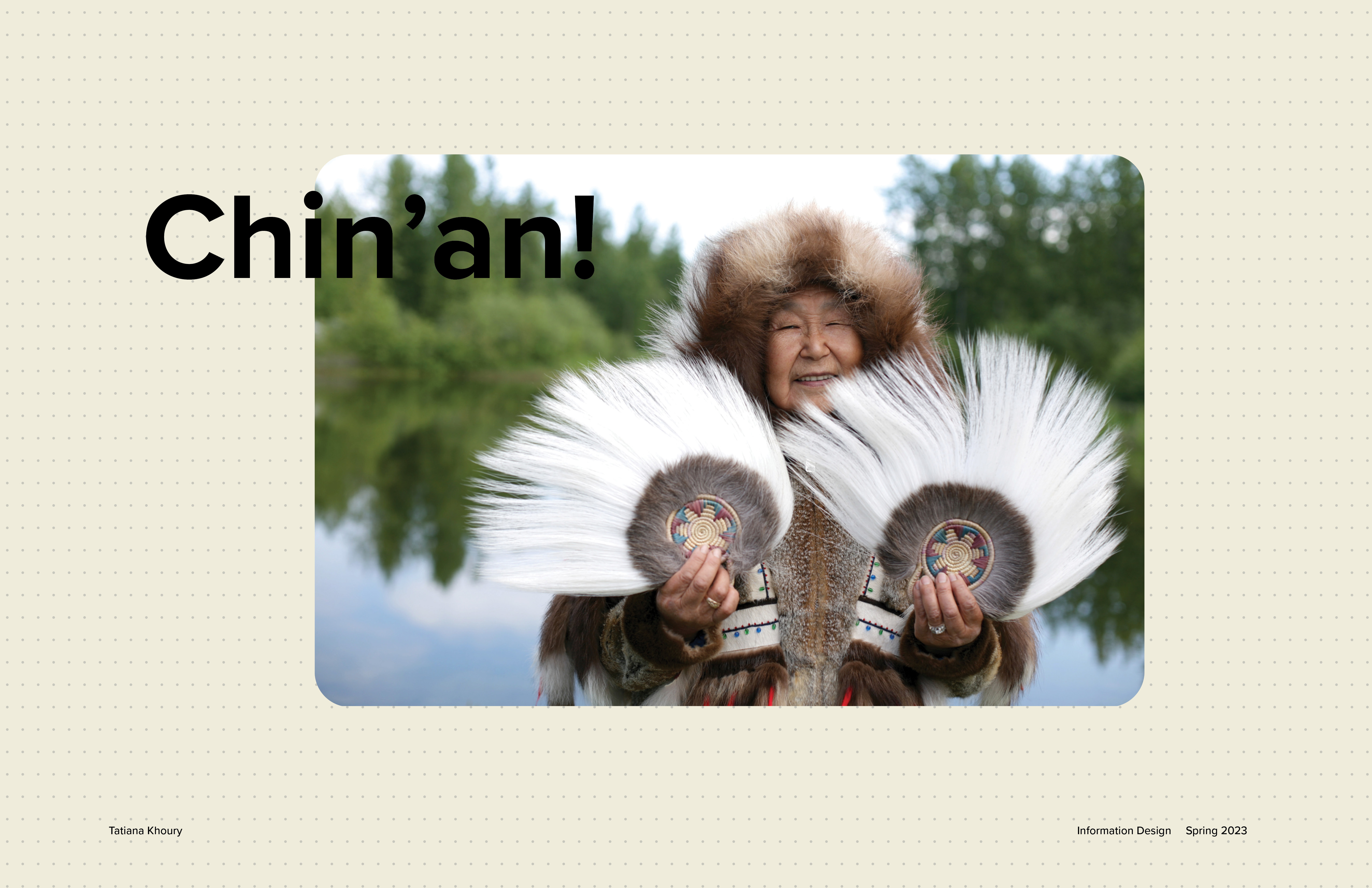
To respect those who came before, I end my presentation by saying thank you in Dena'ina